


Site Planning 101: What Happens Before Design Even Starts
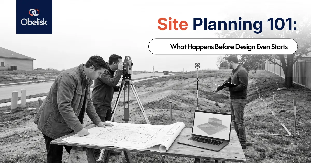
Most people assume a building project starts with a floor plan. It doesn't. Long before anyone sketches a room layout, a separate body of work has to happen: understanding the land itself, what it allows, what it restricts, and what it will cost to work with. That's site planning, and skipping or rushing it is one of the most reliable ways to end up with a redesign six weeks into documentation.
This article walks through what site planning actually involves in practice: the information that gets collected, who collects it, how it shapes the design that follows, and where projects go wrong when this stage gets treated as a formality rather than the foundation it actually is.
What Site Planning Actually Means
Site planning is the process of assessing a piece of land and determining how it can be developed before any building design begins. It covers the physical characteristics of the site (topography, soil, drainage, existing structures), the regulatory conditions that govern what can be built there (zoning, setbacks, overlays), and the practical logistics of access, services, and construction feasibility.
The output isn't a finished design. It's a body of information and a set of constraints and opportunities that the design team then works within. A site plan, in the drawing sense, is one deliverable that comes out of this process, but site planning as a discipline is broader than any single drawing.
Quick Summary
Site planning is the analytical process that happens before architectural design begins: surveying the land, assessing zoning and planning controls, checking services and geotechnical conditions, and consolidating all of it into a set of constraints and opportunities the design team works within. Skipping or rushing it is one of the most common reasons projects need expensive redesigns later.
Why Site Planning Comes Before Design
The sequencing isn't arbitrary. A building responds to its site whether the design team accounts for that or not. A floor plan drawn without knowing the site's slope might put a living area exactly where the most expensive excavation would be needed. A layout drawn without checking setbacks might simply be illegal to build. Site planning exists to surface these constraints while they're still cheap to respond to, rather than after a client has emotionally committed to a design that the site can't actually support.
Architects who skip proper site analysis tend to produce designs that look resolved on paper and then require significant rework once someone checks them against the actual land, the actual planning scheme, or the actual services available.
What Information Gets Collected During Site Planning
Boundary and Topographic Surveys
A boundary survey establishes the legal extent of the property, exactly where the title lines sit, which matters enormously once setback requirements come into play. A topographic survey records the physical shape of the land: existing levels, slope, high and low points, and the location of trees, structures, and other features. Getting this wrong, or working from an outdated or inaccurate survey, is one of the most common sources of downstream error in a project.
Existing Conditions and Structures
For a site with existing buildings, whether they're being demolished, retained, or partially reused, an accurate record of what's actually there matters more than what the original approved drawings say is there. A site planning process that relies solely on old drawings rather than verifying conditions on site is working from an assumption, not a fact.
Utilities and Services Mapping
Knowing where water, sewer, stormwater, gas, electricity, and telecommunications infrastructure currently run, and what capacity they have, shapes both what's feasible and where a building can sensibly sit. This is information a design team needs before committing to a scheme, not something to discover once documentation is underway.
Geotechnical Investigation
Soil conditions determine foundation design, and foundation design is one of the more expensive line items to get wrong. A geotechnical investigation, typically involving borehole testing, identifies soil type, bearing capacity, groundwater levels, and any contamination risk.
Assessing Site Constraints
Zoning and Planning Controls
Zoning determines what a site can legally be used for and, within that, what can be built: permissible building height, density, and use classifications all flow from the zoning designation. These controls vary significantly by jurisdiction and local planning scheme, so the specific requirements always need to be confirmed against the relevant planning authority for that site.
Setbacks and Overlays
Setback requirements dictate how far a building must sit from property boundaries, and they interact with other controls like height limits and site coverage to define what's often called the building envelope. Planning overlays add further layers of restriction: heritage, flood, bushfire management, and vegetation protection overlays are common examples, and a site can carry several simultaneously.
Access and Circulation
How people, vehicles, and services actually reach and move around a site affects far more than convenience. Vehicle access points interact with road authority requirements and sightline regulations, and pedestrian, emergency vehicle, and accessible path requirements all need to be resolved at the planning stage.
Drainage and Stormwater
Water has to go somewhere, and a site plan needs to account for how stormwater will be managed both during construction and once the building exists, including any on-site detention or retention requirements imposed by local authorities.
Environmental Constraints
Depending on location, environmental constraints might include protected vegetation, wildlife corridors, wetlands, coastal erosion risk, or bushfire-prone area classifications. Addressing them early tends to produce a better outcome than treating them as boxes to tick once a design is already locked in.
Expert Tip: ConfirmConfirm zoning, overlays, and setbacks directly with the relevant planning authority for the specific site, not from a comparable project. Planning schemes vary enough between neighboring sites that assumptions carried over from a previous job are a common source of late-stage rework.
The Site Planning Process Step by Step
Initial site investigation
What Happens: Desktop review of title, zoning, overlays, and available records
Typical Contributors: Planner, architect
Survey commissioning
What Happens: Boundary and topographic survey of the actual site
Typical Contributors: Licensed surveyor
Geotechnical assessment
What Happens: Soil testing and foundation feasibility review
Typical Contributors: Geotechnical engineer
Services and utilities check
What Happens: Confirming location and capacity of existing infrastructure
Typical Contributors: Civil engineer, service authorities
Constraints mapping
What Happens: Consolidating zoning, overlays, setbacks, and physical constraints
Typical Contributors: Architect, planner
Feasibility and massing testing
What Happens: Testing what building envelope and program the site supports
Typical Contributors: Architect, developer
Site plan documentation
What Happens: Producing the site plan and analysis for design and approvals
Typical Contributors: Architect, civil engineer
Who's Involved in Site Planning
Site planning is rarely a single-discipline exercise, even on straightforward projects. The mix of contributors scales with project complexity, but the core relationships are consistent.
Architect
Contribution: Leads the overall site response, translates constraints into design opportunities
Civil engineer
Contribution: Handles drainage, stormwater, grading, and services coordination
Surveyor
Contribution: Provides boundary and topographic survey data as the factual base layer
Town planner
Contribution: Advises on zoning, overlays, and the planning approval pathway
Geotechnical consultant
Contribution: Assesses soil and foundation conditions
Environmental consultant
Contribution: Addresses ecological, contamination, or bushfire constraints where relevant
Structural engineer
Contribution: Provides early input on foundation and structural feasibility
BIM coordinator
Contribution: Manages the digital site model and coordination between contributors
Developer or owner
Contribution: Sets the brief, budget, and risk tolerance the site plan needs to work within
How Site Planning Decisions Shape the Design That Follows
Every constraint identified during site planning becomes a parameter the design has to work within, and often a genuine design driver rather than just a limitation. A steep site might push a design toward a split-level or stepped form rather than a single flat floor plate, which can become one of the more distinctive features of the finished building rather than a compromise.
This is why experienced design teams treat site planning as a source of design direction, not just a compliance checklist. A design that responds genuinely to its site constraints tends to need less BIM coordination rework later, because it was never fighting the land it sits on in the first place.
How BIM and Digital Tools Support Site Planning
Digital tools have changed how much of this analysis can happen before a design decision gets made, rather than after. A topographic survey imported into a 3D model lets a design team test building placement and massing directly against the actual site levels. Overlaying zoning envelopes, setback lines, and overlay boundaries onto that same model surfaces conflicts immediately: a proposed footprint that clips a setback line is visible the moment it's drawn, not discovered during a later compliance check.
BIM's value in site planning specifically comes from linking the site model to the same coordinate system the building design will use as part of full modelling and documentation, so there's no translation error between the site information gathered early and the design work that follows.
Traditional Site Planning vs Digital Site Planning
Survey data
Traditional Approach: 2D contour plans, manually interpreted
Digital, Model-Based Approach: 3D topographic model, directly testable against design
Constraint checking
Traditional Approach: Manual cross-referencing of setbacks and overlays
Digital, Model-Based Approach: Overlaid digital envelopes, conflicts visible immediately
Massing and feasibility testing
Traditional Approach: Hand sketches and rough area calculations
Digital, Model-Based Approach: 3D massing tested against real site levels and constraints
Consultant coordination
Traditional Approach: Separate reports and drawings exchanged periodically
Digital, Model-Based Approach: Shared model referenced by all site-related consultants
Design iteration
Traditional Approach: Slow, each option redrawn manually
Digital, Model-Based Approach: Faster, options tested and compared directly against site data
Common Site Planning Mistakes
Relying on outdated or assumed survey information. Working from an old survey, or worse, no survey at all, means every subsequent decision rests on an unverified assumption.
Treating planning controls as a final check rather than an early input. Confirming zoning, setbacks, and overlays after a design concept is already developed routinely forces a redesign that could have been avoided.
Underestimating geotechnical risk. Skipping or minimizing geotechnical investigation tends to surface as a foundation cost surprise later, once the design has already committed to a specific structural approach.
Ignoring service capacity. Assuming existing utilities can support a new development without confirming capacity with the relevant authority can derail feasibility after significant design investment.
Sequencing site planning and design as one-way steps. The best outcomes happen when site information continues to inform design decisions iteratively, not when it's ticked once and never revisited.
What a Good Site Planning Process Looks Like
- A current, accurate boundary and topographic survey commissioned specifically for this project.
- Zoning, overlays, and planning controls confirmed directly with the relevant planning authority.
- Geotechnical investigation scoped appropriately for the site's risk profile and structure being considered.
- Utilities and services capacity confirmed with the relevant authorities before a scheme is finalized.
- Access, circulation, and drainage strategies tested against the site's actual conditions.
- Environmental and heritage constraints identified early enough to shape the design.
- Everything consolidated into a single, shared reference the whole project team works from.
How Early Site Planning Reduces Project Risk
Every constraint caught during site planning is a constraint that doesn't surface later as a costly surprise, a redesign, a planning objection, or a construction-stage delay. A setback issue found before concept design costs an adjusted footprint. The same issue found during a planning application can cost months of resubmission. Found during construction, after a slab has been poured in the wrong position, it can cost a genuine rebuild.
This is also where the connection between site planning and later BIM coordination becomes clear. A project that starts with accurate, model-based site information carries that accuracy forward into design coordination and virtual construction, rather than having to reconcile inconsistencies that crept in early.
Frequently Asked Questions
What is site planning in simple terms?
Site planning is the process of assessing a piece of land, its physical conditions, regulatory constraints, and practical limitations, before architectural design begins, so the design responds to what the site can actually support.
Why is site planning important before design starts?
Because a building has to respond to its site whether that's planned for or not. Identifying constraints like setbacks, slope, drainage, and services capacity early avoids expensive redesigns once a concept has already been approved by a client.
What's the difference between a site plan and site planning?
A site plan is a specific drawing showing how a building sits on its site. Site planning is the broader analytical process, surveys, constraint assessment, feasibility testing, that produces the information behind that drawing.
What information is needed before site planning can begin?
A current boundary and topographic survey, confirmation of zoning and applicable planning overlays, and, depending on the site, geotechnical and services information are the core inputs most projects need.
Who is responsible for site planning on a project?
It's typically led by the architect or a town planner, working with a surveyor, civil engineer, and geotechnical consultant, with the specific mix depending on project scale and site complexity.
How long does site planning take?
It varies significantly by site complexity, jurisdiction, and how quickly surveys and specialist reports can be commissioned, so timelines depend on the specific project.
What is a topographic survey, and why does it matter for site planning?
A topographic survey records a site's physical features, existing levels, slope, and the location of trees and structures. It's the factual base layer every subsequent decision is measured against.
How do zoning and planning controls affect site planning?
Zoning determines what a site can legally be used for and constrains height, density, and setbacks, which together define the buildable envelope. These controls vary by jurisdiction and need to be confirmed with the relevant planning authority.
What role does geotechnical investigation play in site planning?
It identifies soil conditions, bearing capacity, and groundwater or contamination risk, which directly influence foundation design and, in some cases, project feasibility.
How does BIM support the site planning process?
BIM lets site survey data, zoning envelopes, and constraint information be tested directly in a 3D model, surfacing conflicts immediately rather than during a later manual check.
What are the most common site planning mistakes?
Relying on outdated survey data, confirming planning controls too late, underestimating geotechnical risk, and assuming services capacity without confirming it are among the most frequent and costly mistakes.
Does every project need the same level of site planning?
No. The depth scales with site complexity and project risk, but the underlying process of verifying rather than assuming applies to every project.
Can site planning issues be fixed once design has started?
Sometimes, but the cost and disruption increase the later they're discovered, from a manageable adjustment pre-concept to a considerably more expensive fix during construction.
Call to Action
Good site planning is the difference between a design that fits its site naturally and one that's been forced onto it. If you're starting a project and want the site planning and early BIM coordination handled properly from day one, talk to us.
TABLE OF CONTENTS




















.png)
.png)
.webp)